
Belleair topographic map
Interactive map
Click on the map to display elevation.
About this map
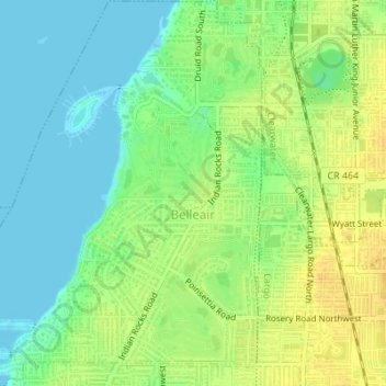
Name: Belleair topographic map, elevation, terrain.
Location: Belleair, Pinellas County, Florida, United States (27.92240 -82.82923 27.95267 -82.79990)
Average elevation: 13 m
Minimum elevation: -1 m
Maximum elevation: 27 m
Other topographic maps
Click on a map to view its topography, its elevation and its terrain.