
Bahir Dar zone spéciale topographic map
Interactive map
Click on the map to display elevation.
About this map
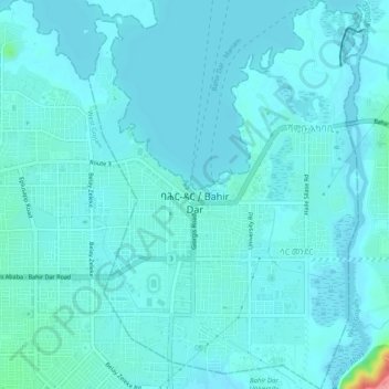
Name: Bahir Dar zone spéciale topographic map, elevation, terrain.
Location: Bahir Dar zone spéciale, Amhara, Éthiopie (11.57123 37.37451 11.62033 37.40922)
Average elevation: 1,794 m
Minimum elevation: 1,783 m
Maximum elevation: 1,885 m
Other topographic maps
Click on a map to view its topography, its elevation and its terrain.