Geolocate

Williamsport topographic map

Click on the map to display elevation.

About this map

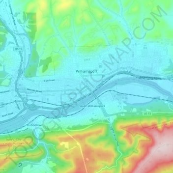
Name: Williamsport topographic map, elevation, terrain.

Location: Williamsport, Lycoming County, Pennsylvania, United States (41.21872 -77.09593 41.26456 -76.98168)

Average elevation: 253 m

Minimum elevation: 149 m

Maximum elevation: 615 m

Gear up for your next adventure:

📕Australia Maps - Maps covering Australian regions
Outdoor Coffee Makers - Enjoy quality coffee at the summit of your favorite peak
🧢Outdoor Sun Hats - Sun protection hats for hiking
🍴Titanium Spork & Cutlery - Indestructible and feather-light eating utensils
Altimeter Barometer Watches - Outdoor watches with built-in sensors to track altitude changes and weather shifts

As an Amazon Associate, this site earns from qualifying purchases at no extra cost to you.