Geolocate

Sandy topographic map

Click on the map to display elevation.

About this map

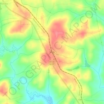
Name: Sandy topographic map, elevation, terrain.

Location: Sandy, Butts County, Georgia, 30216, United States (33.21512 -83.89629 33.25512 -83.85629)

Average elevation: 164 m

Minimum elevation: 126 m

Maximum elevation: 201 m

Gear up for your next adventure:

🐍Snake Gaiters - Protection against snake bites
🧤Hiking Gloves - Protective gloves for outdoor use
🦟Insect Repellent - Protection against insects
🔭Compact Hiking Binoculars - Lightweight optics for scouting routes or birdwatching
🎒Hiking Backpacks - Backpacks designed for hiking and trekking

As an Amazon Associate, this site earns from qualifying purchases at no extra cost to you.