Geolocate

Pur topographic map

Click on the map to display elevation.

About this map
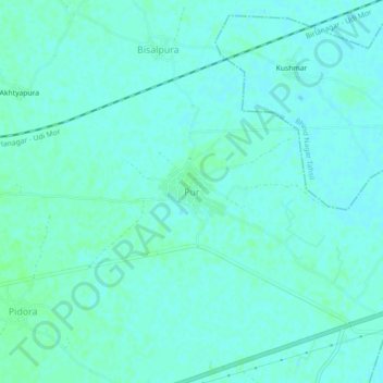
Name: Pur topographic map, elevation, terrain.

Location: Pur, Bhind Tahsil, Bhind, Madhya Pradesh, India (26.53717 78.70213 26.57717 78.74213)

Average elevation: 153 m

Minimum elevation: 150 m

Maximum elevation: 156 m

Other topographic maps

Click on a map to view its topography, its elevation and its terrain.

Narsinghgarh

India > Madhya Pradesh > Bhind Tahsil > Narsinghgarh

Average elevation: 150 m

Misa

India > Madhya Pradesh > Bhind Tahsil > Kishan Ki Garhia

Average elevation: 136 m

Gear up for your next adventure:

🦟Insect Repellent - Protection against insects
👄SPF Lip Balm - Prevent sun and wind-burnt lips on mountain ridges
🎒Dry Bags - Waterproof bags for outdoor gear
🪑Portable Backpacking Chairs - A comfortable seat for studying maps at the end of the day
🍳Ultralight Camping Stoves - Boil water quickly for meals using minimal fuel

As an Amazon Associate, this site earns from qualifying purchases at no extra cost to you.