

Meudon topographic map
Click on the map to display elevation.
Meudon
The old castle of Meudon was rebuilt in Renaissance style in the mid-sixteenth century. It was bought by Louis XIV as a residence for his son Louis, the Dauphin under whom Meudon became a center of aristocratic life. After the death of the Dauphin in 1711, the château was neglected, emptied in the Revolutionary sales, and finally burned in 1871 at the close of the Franco-Prussian War, while it was occupied by Prussian soldiers. A branch of the Paris Observatory was founded on the ruins in 1877. The Meudon town hall is about 43 m (141.08 ft) in altitude above that of Paris and the climb from there to the observatory offers some rewarding views of Paris.
About this map
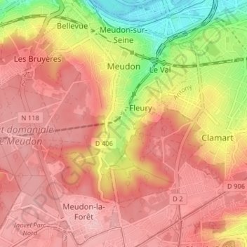
Name: Meudon topographic map, elevation, terrain.
Average elevation: 132 m
Minimum elevation: 28 m
Maximum elevation: 187 m