Geolocate

City of Spruce Grove topographic map

Click on the map to display elevation.

About this map

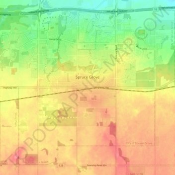
Name: City of Spruce Grove topographic map, elevation, terrain.

Location: City of Spruce Grove, Division No. 11, Alberta, Canada (53.51221 -113.95906 53.57026 -113.84858)

Average elevation: 699 m

Minimum elevation: 659 m

Maximum elevation: 731 m

Other topographic maps

Click on a map to view its topography, its elevation and its terrain.

Southwood

Canada > Alberta > Division No. 11

Southwood, Mill Woods, Division No. 11, Alberta, Canada

Average elevation: 710 m

Woodcroft

Canada > Alberta > Division No. 11

Woodcroft, Western Mature Area, Division No. 11, Alberta, Canada

Average elevation: 673 m

Callaghan

Canada > Alberta > Division No. 11

Callaghan, Heritage Valley, Division No. 11, Alberta, T6W 0R7, Canada

Average elevation: 694 m