
Molėtai topographic map
Interactive map
Click on the map to display elevation.
About this map
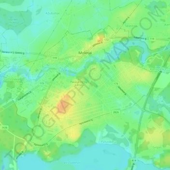
Name: Molėtai topographic map, elevation, terrain.
Location: Molėtai, Molėtų rajono savivaldybė, Utena County, Lithuania (55.21414 25.38976 55.23720 25.44721)
Average elevation: 155 m
Minimum elevation: 141 m
Maximum elevation: 176 m
Other topographic maps
Click on a map to view its topography, its elevation and its terrain.
Suginčiai
Lithuania > Utena County > Suginčiai eldership > Suginčiai
Suginčiai, Suginčiai eldership, Molėtų rajono savivaldybė, Utena County, 33334, Lithuania
Average elevation: 170 m