
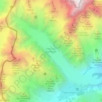
Ghiacciaio del Miage topographic map
Interactive map
Click on the map to display elevation.
About this map
Name: Ghiacciaio del Miage topographic map, elevation, terrain.
Average elevation: 2,911 m
Minimum elevation: 1,797 m
Maximum elevation: 4,737 m
Other topographic maps
Click on a map to view its topography, its elevation and its terrain.
Larzey
Italy > Aosta Valley > Courmayeur
Larzey, Courmayeur, Aosta Valley, 11013, Italy
Average elevation: 1,596 m
Mont Blanc - Monte Bianco
Italy > Aosta Valley > Courmayeur
Mont Blanc - Monte Bianco, Sentiero per Rifugio Monzino, Courmayeur, Aosta Valley, Italy
Average elevation: 4,092 m
Val Veny
Italy > Aosta Valley > Courmayeur
Val Veny, Courmayeur, Aosta Valley, Italy
Average elevation: 2,151 m