
Thank you for supporting this site ❤️
Make a donation
Make a donation
Gear up for your next adventure:
As an Amazon Associate, this site earns from qualifying purchases at no extra cost to you.
Thurmaston topographic map
Click on the map to display elevation.
Thank you for supporting this site ❤️
Make a donation
Make a donation
Gear up for your next adventure:
As an Amazon Associate, this site earns from qualifying purchases at no extra cost to you.
About this map
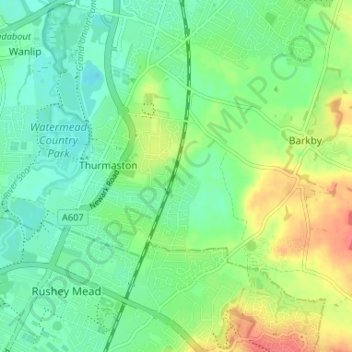
Name: Thurmaston topographic map, elevation, terrain.
Location: Thurmaston, Charnwood, Leicestershire, England, United Kingdom (52.66315 -1.11672 52.69229 -1.05124)
Average elevation: 62 m
Minimum elevation: 43 m
Maximum elevation: 96 m
Thank you for supporting this site ❤️
Make a donation
Make a donation
Gear up for your next adventure:
As an Amazon Associate, this site earns from qualifying purchases at no extra cost to you.