
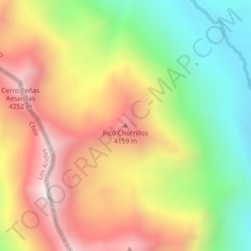
Pico Chorrillos topographic map
Interactive map
Click on the map to display elevation.
About this map
Name: Pico Chorrillos topographic map, elevation, terrain.
Average elevation: 3,791 m
Minimum elevation: 3,302 m
Maximum elevation: 4,288 m
Other topographic maps
Click on a map to view its topography, its elevation and its terrain.
Cordillera de los Andes
Argentina > Mendoza > Distrito Las Cuevas
Cordillera de los Andes, Distrito Las Cuevas, Departamento Las Heras, Mendoza, Argentina
Average elevation: 6,208 m
Aconcagua
Argentina > Mendoza > Distrito Las Cuevas
Aconcagua, Distrito Las Cuevas, Departamento Las Heras, Mendoza, Argentina
Average elevation: 6,201 m
Distrito Las Cuevas
Argentina > Mendoza > Distrito Las Cuevas
Distrito Las Cuevas, Departamento Las Heras, Mendoza, Argentina
Average elevation: 3,978 m