
Thank you for supporting this site ❤️
Make a donation
Make a donation
Gear up for your next adventure:
As an Amazon Associate, this site earns from qualifying purchases at no extra cost to you.
Moulin topographic map
Click on the map to display elevation.
Thank you for supporting this site ❤️
Make a donation
Make a donation
Gear up for your next adventure:
As an Amazon Associate, this site earns from qualifying purchases at no extra cost to you.
About this map
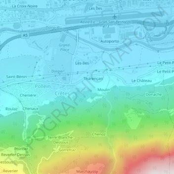
Name: Moulin topographic map, elevation, terrain.
Location: Moulin, Tharençan, Crêtes, Pollein, Aosta Valley, Italy (45.72214 7.35830 45.73356 7.37364)
Average elevation: 745 m
Minimum elevation: 535 m
Maximum elevation: 1,636 m
Thank you for supporting this site ❤️
Make a donation
Make a donation
Gear up for your next adventure:
As an Amazon Associate, this site earns from qualifying purchases at no extra cost to you.