
Susie topographic map
Interactive map
Click on the map to display elevation.
About this map
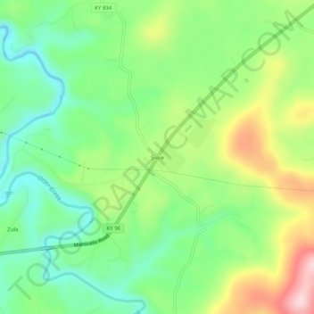
Name: Susie topographic map, elevation, terrain.
Location: Susie, Wayne County, Kentucky, United States (36.75646 -84.97634 36.79646 -84.93634)
Average elevation: 302 m
Minimum elevation: 207 m
Maximum elevation: 462 m
Other topographic maps
Click on a map to view its topography, its elevation and its terrain.
Little Pilot Knob
United States > Kentucky > Wayne County
Little Pilot Knob, Wayne County, Kentucky, United States
Average elevation: 374 m
Monticello
United States > Kentucky > Wayne County
Monticello, Wayne County, Kentucky, 42633, United States
Average elevation: 304 m