
Thank you for supporting this site ❤️
Make a donation
Make a donation
Gear up for your next adventure:
As an Amazon Associate, this site earns from qualifying purchases at no extra cost to you.
A Teixeira topographic map
Click on the map to display elevation.
Thank you for supporting this site ❤️
Make a donation
Make a donation
Gear up for your next adventure:
As an Amazon Associate, this site earns from qualifying purchases at no extra cost to you.
About this map
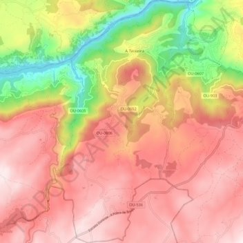
Name: A Teixeira topographic map, elevation, terrain.
Location: A Teixeira, Terra de Caldelas, Ourense, Galicia, Spain (42.32825 -7.51012 42.40786 -7.43139)
Average elevation: 663 m
Minimum elevation: 202 m
Maximum elevation: 1,062 m
Thank you for supporting this site ❤️
Make a donation
Make a donation
Gear up for your next adventure:
As an Amazon Associate, this site earns from qualifying purchases at no extra cost to you.