
Thank you for supporting this site ❤️
Make a donation
Make a donation
Gear up for your next adventure:
As an Amazon Associate, this site earns from qualifying purchases at no extra cost to you.
Shey topographic map
Click on the map to display elevation.
Thank you for supporting this site ❤️
Make a donation
Make a donation
Gear up for your next adventure:
As an Amazon Associate, this site earns from qualifying purchases at no extra cost to you.
About this map
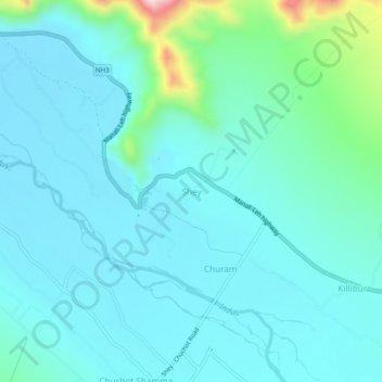
Name: Shey topographic map, elevation, terrain.
Location: Shey, Leh Tehsil, Leh district, Ladakh, 194201, India (34.05134 77.61972 34.09134 77.65972)
Average elevation: 3,282 m
Minimum elevation: 3,225 m
Maximum elevation: 3,598 m
Thank you for supporting this site ❤️
Make a donation
Make a donation
Gear up for your next adventure:
As an Amazon Associate, this site earns from qualifying purchases at no extra cost to you.