
City of Georgetown topographic map
Interactive map
Click on the map to display elevation.
City of Georgetown
Georgetown is located on Guyana's Atlantic coast on the east bank of Demerara River estuary. The terrain in this part of the country where the city is located is flat coastal plains. The city is surrounded by a blanket of cane fields along with marshy swamps, and savannah lands on its east and south. The elevation of the land is one metre below the high tide level. This low elevation is protected by a retaining wall known as the seawall to keep the ocean out and an innovative network of canals with kokers to drain the city of excess water.
About this map
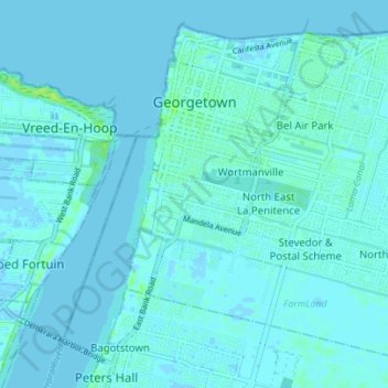
Name: City of Georgetown topographic map, elevation, terrain.
Average elevation: 2 m
Minimum elevation: -3 m
Maximum elevation: 11 m
Other topographic maps
Click on a map to view its topography, its elevation and its terrain.