Geolocate

Spur topographic map

Click on the map to display elevation.

About this map

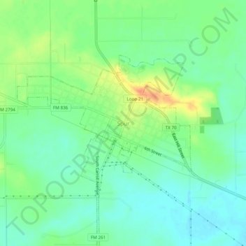
Name: Spur topographic map, elevation, terrain.

Location: Spur, Dickens County, Texas, 79370, United States (33.45648 -100.87569 33.49648 -100.83569)

Average elevation: 692 m

Minimum elevation: 677 m

Maximum elevation: 719 m

Gear up for your next adventure:

🧢Wide Brim Sun Hats - Maximum coverage for the face and neck while out in the open
🧊Insulated Cooler Bags - Keep food fresh for day trips to remote geographic sites
🥾Hiking Boots - Durable hiking boots for trails and rough terrain
🔌Fast Charging Adapters - Quickly top up all your gear before heading back into the field
🧦Merino Wool Hiking Socks - Moisture-wicking socks to prevent blisters during long topographic surveys

As an Amazon Associate, this site earns from qualifying purchases at no extra cost to you.