Geolocate

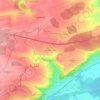
Roggenburg topographic map

Click on the map to display elevation.

About this map

Name: Roggenburg topographic map, elevation, terrain.

Location: Roggenburg, Landkreis Neu-Ulm, Bavaria, 89297, Germany (48.25030 10.18563 48.32329 10.26477)

Average elevation: 530 m

Minimum elevation: 484 m

Maximum elevation: 568 m

Other topographic maps

Click on a map to view its topography, its elevation and its terrain.
Wullenstetten

Germany > Bavaria > Landkreis Neu-Ulm > Senden

Average elevation: 504 m

Gear up for your next adventure:

📣High-Decibel Survival Whistles - Signaling tool for rescue that carries much further than a human voice
🧥Thermal Emergency Blankets - Compact Mylar blankets to prevent hypothermia if stranded overnight
📱Shockproof Phone Cases - Extra protection for your smartphone against drops on rocky terrain
📷Backpack Camera Clips - Quick access to your camera while keeping your hands free for climbing
🧦Merino Wool Hiking Socks - Moisture-wicking socks to prevent blisters during long topographic surveys

As an Amazon Associate, this site earns from qualifying purchases at no extra cost to you.