Geolocate

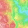
Box Elder Hutterite Colony topographic map

Click on the map to display elevation.

About this map

Name: Box Elder Hutterite Colony topographic map, elevation, terrain.

Location: Box Elder Hutterite Colony, Maple Creek No. 111, Saskatchewan, Canada (49.76908 -109.90832 49.80908 -109.86832)

Average elevation: 948 m

Minimum elevation: 905 m

Maximum elevation: 988 m

Other topographic maps

Click on a map to view its topography, its elevation and its terrain.
Loch Leven

Canada > Saskatchewan > Maple Creek No. 111

Average elevation: 1,227 m

Gear up for your next adventure:

🕶️Polarized Sunglasses - UV protection sunglasses for outdoors
🖼️Scratch-off Australia Map - Track the regions and peaks you have explored geographically
📕Australia Maps - Maps covering Australian regions
🧣Merino Neck Gaiters - Versatile headwear for warmth, sun protection, or dust filtering
🔪Camping Knives - Multi-purpose outdoor knives

As an Amazon Associate, this site earns from qualifying purchases at no extra cost to you.