
Glenview topographic map
Click on the map to display elevation.
About this map
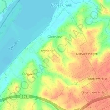
Name: Glenview topographic map, elevation, terrain.
Location: Glenview, Jefferson County, Kentucky, 40025, United States (38.29246 -85.66656 38.31534 -85.63772)
Average elevation: 155 m
Minimum elevation: 131 m
Maximum elevation: 183 m
Other topographic maps
Click on a map to view its topography, its elevation and its terrain.