
Aguas Verdes topographic map
Interactive map
Click on the map to display elevation.
About this map
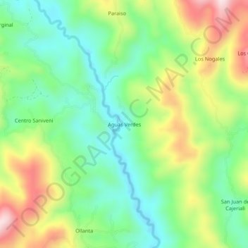
Name: Aguas Verdes topographic map, elevation, terrain.
Location: Aguas Verdes, Mazamari, Satipo, Junín, Perú (-11.48747 -74.37841 -11.44747 -74.33841)
Average elevation: 1,181 m
Minimum elevation: 1,031 m
Maximum elevation: 1,430 m