
Rio Henares topographic map
Interactive map
Click on the map to display elevation.
About this map
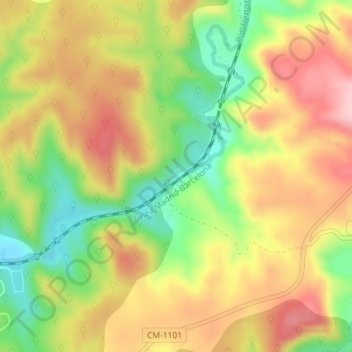
Name: Rio Henares topographic map, elevation, terrain.
Location: Rio Henares, Sigüenza, Guadalajara, Castilla-La Mancha, España (41.01501 -2.69827 41.01617 -2.69649)
Average elevation: 1,007 m
Minimum elevation: 904 m
Maximum elevation: 1,100 m
Other topographic maps
Click on a map to view its topography, its elevation and its terrain.
Alto de la Guijarrosa
España > Castilla-La Mancha > Sigüenza
Alto de la Guijarrosa, Sigüenza, Guadalajara, Castilla-La Mancha, España
Average elevation: 1,143 m
Pelegrina
España > Castilla-La Mancha > Sigüenza > Pelegrina
Pelegrina, Sigüenza, Guadalajara, Castilla-La Mancha, 19268, España
Average elevation: 1,078 m