
Thank you for supporting this site ❤️
Make a donation
Make a donation
Gear up for your next adventure:
As an Amazon Associate, this site earns from qualifying purchases at no extra cost to you.
Rosablanche topographic map
Click on the map to display elevation.
Thank you for supporting this site ❤️
Make a donation
Make a donation
Gear up for your next adventure:
As an Amazon Associate, this site earns from qualifying purchases at no extra cost to you.
About this map
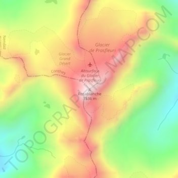
Name: Rosablanche topographic map, elevation, terrain.
Location: Rosablanche, Hérémence, Hérens, Wallis, 1987, Switzerland (46.06046 7.35419 46.06056 7.35429)
Average elevation: 2,952 m
Minimum elevation: 2,592 m
Maximum elevation: 3,317 m
Thank you for supporting this site ❤️
Make a donation
Make a donation
Gear up for your next adventure:
As an Amazon Associate, this site earns from qualifying purchases at no extra cost to you.