Geolocate

Warragul topographic map

Click on the map to display elevation.

About this map

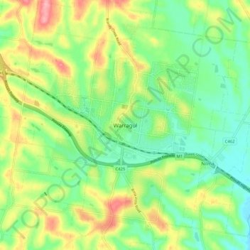
Name: Warragul topographic map, elevation, terrain.

Location: Warragul, Shire of Baw Baw, Victoria, 3820, Australia (-38.19887 145.89363 -38.11887 145.97363)

Average elevation: 133 m

Minimum elevation: 87 m

Maximum elevation: 208 m

Victoria trails, hiking, mountain biking, running and outdoor activities

Gear up for your next adventure:

Survival Blankets - Emergency thermal blankets
🔋Rechargeable Batteries - Eco-friendly power for high-drain GPS units and flashlights
🪫Rechargeable Headlamps - USB rechargeable headlamps
🧳Outdoor Travel Organizers - Gear organization accessories
🥾Hiking Gaiters - Leg protection for trails

As an Amazon Associate, this site earns from qualifying purchases at no extra cost to you.