
Putney Heath topographic map
Interactive map
Click on the map to display elevation.
About this map
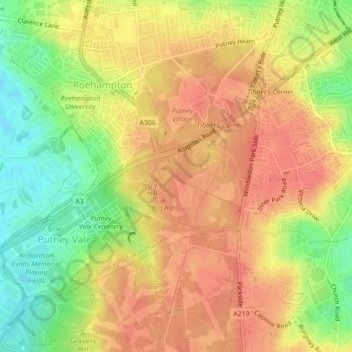
Name: Putney Heath topographic map, elevation, terrain.
Average elevation: 39 m
Minimum elevation: 6 m
Maximum elevation: 58 m
Other topographic maps
Click on a map to view its topography, its elevation and its terrain.
Brentford Ait
Reino Unido > Inglaterra > Londres
Brentford Ait, Richmond-upon-Thames, Londres, Greater London, Inglaterra, Reino Unido
Average elevation: 11 m