
Lamezia Terme topographic map
Interactive map
Click on the map to display elevation.
About this map
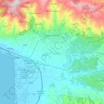
Name: Lamezia Terme topographic map, elevation, terrain.
Location: Lamezia Terme, Catanzaro, Calabre, Italie (38.84927 16.21497 39.02354 16.36857)
Average elevation: 298 m
Minimum elevation: -1 m
Maximum elevation: 1,322 m
Other topographic maps
Click on a map to view its topography, its elevation and its terrain.