Geolocate

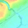
Minesing topographic map

Click on the map to display elevation.

About this map

Name: Minesing topographic map, elevation, terrain.

Location: Minesing, Springwater, Simcoe County, Central Ontario, Ontario, L9X 1J2, Canada (44.42298 -79.86237 44.46298 -79.82237)

Average elevation: 196 m

Minimum elevation: 179 m

Maximum elevation: 230 m

Other topographic maps

Click on a map to view its topography, its elevation and its terrain.
Gear up for your next adventure:

🪢550 Survival Paracord - Versatile cordage for gear repair and emergency lashing
⌚Altimeter Watches - Watches with altitude tracking
🧢Wide Brim Sun Hats - Maximum coverage for the face and neck while out in the open
🏕️Camping Gear - Essential camping equipment
👣Snake & Scrub Gaiters - Protection against spinifex, mud, and snakes while walking off-track

As an Amazon Associate, this site earns from qualifying purchases at no extra cost to you.