Geolocate

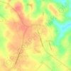
Waverly topographic map

Click on the map to display elevation.

About this map

Name: Waverly topographic map, elevation, terrain.

Location: Waverly, San Jacinto County, Texas, United States (30.50492 -95.37050 30.54492 -95.33050)

Average elevation: 117 m

Minimum elevation: 81 m

Maximum elevation: 138 m

Other topographic maps

Click on a map to view its topography, its elevation and its terrain.
Point Blank

United States > Texas > San Jacinto County

Average elevation: 54 m

Coldspring

United States > Texas > San Jacinto County

Average elevation: 103 m

Coldspring

United States > Texas > San Jacinto County

Average elevation: 103 m

Shepherd

United States > Texas > San Jacinto County

Average elevation: 45 m

Gear up for your next adventure:

🥾Hiking Boots - Durable hiking boots for trails and rough terrain
📍Handheld GPS - GPS devices for hiking and navigation
💡Collapsible Camping Lanterns - Illuminate your base camp or tent for map studying at night
🧴Sunscreen SPF - Sun protection for outdoor activities
🔋Solar Power Banks - Solar chargers for outdoors

As an Amazon Associate, this site earns from qualifying purchases at no extra cost to you.