
Dannstadt topographic map
Interactive map
Click on the map to display elevation.
About this map
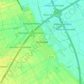
Name: Dannstadt topographic map, elevation, terrain.
Average elevation: 101 m
Minimum elevation: 93 m
Maximum elevation: 109 m
Other topographic maps
Click on a map to view its topography, its elevation and its terrain.
Schauernheim
Deutschland > Rheinland-Pfalz > Rhein-Pfalz-Kreis > Dannstadt-Schauernheim
Schauernheim, Dannstadt-Schauernheim, Rhein-Pfalz-Kreis, Rheinland-Pfalz, 67125, Deutschland
Average elevation: 100 m