
Thank you for supporting this site ❤️
Make a donation
Make a donation
Gear up for your next adventure:
As an Amazon Associate, this site earns from qualifying purchases at no extra cost to you.
Windsbach topographic map
Click on the map to display elevation.
Thank you for supporting this site ❤️
Make a donation
Make a donation
Gear up for your next adventure:
As an Amazon Associate, this site earns from qualifying purchases at no extra cost to you.
About this map
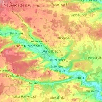
Name: Windsbach topographic map, elevation, terrain.
Location: Windsbach, Landkreis Ansbach, Bayern, 91575, Deutschland (49.20892 10.78906 49.28892 10.86906)
Average elevation: 416 m
Minimum elevation: 368 m
Maximum elevation: 457 m
Thank you for supporting this site ❤️
Make a donation
Make a donation
Gear up for your next adventure:
As an Amazon Associate, this site earns from qualifying purchases at no extra cost to you.