Geolocate

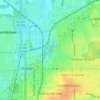
Fort McCoy topographic map

Click on the map to display elevation.

About this map

Name: Fort McCoy topographic map, elevation, terrain.

Location: Fort McCoy, Marion County, Florida, 34489, United States (29.34497 -81.98703 29.38497 -81.94703)

Average elevation: 20 m

Minimum elevation: 6 m

Maximum elevation: 31 m

Other topographic maps

Click on a map to view its topography, its elevation and its terrain.
Ocala

United States > Florida > Marion County

Ocala features a varied terrain of rolling hills, gently undulating plains, and rich limestone formations typical of north-central Florida. The area rests at an elevation that generally ranges from around 50 to 150 feet above sea level, with pockets of higher ground providing scenic overlooks and natural…

Average elevation: 28 m
Dunnellon

United States > Florida > Marion County

Average elevation: 21 m

Lake Kerr

United States > Florida > Marion County > Salt Springs

Average elevation: 19 m

Belleview

United States > Florida > Marion County

Average elevation: 29 m

Reddick

United States > Florida > Marion County

Average elevation: 33 m

Ocala

United States > Florida > Marion County

Average elevation: 28 m

Ocala

United States > Florida > Marion County

Average elevation: 28 m

Belleview

United States > Florida > Marion County

Average elevation: 29 m

Lake Tuscawilla

United States > Florida > Marion County > Ocala

Average elevation: 31 m

Gear up for your next adventure:

📱Tablet Tripod Mounts - Steady platforms for viewing digital maps or taking long exposures
📷Backpack Camera Clips - Quick access to your camera while keeping your hands free for climbing
🍳Ultralight Camping Stoves - Boil water quickly for meals using minimal fuel
🍴Titanium Spork & Cutlery - Indestructible and feather-light eating utensils
🚗Car Camping Gear - Equipment for vehicle camping

As an Amazon Associate, this site earns from qualifying purchases at no extra cost to you.