
Avià topographic map
Interactive map
Click on the map to display elevation.
About this map
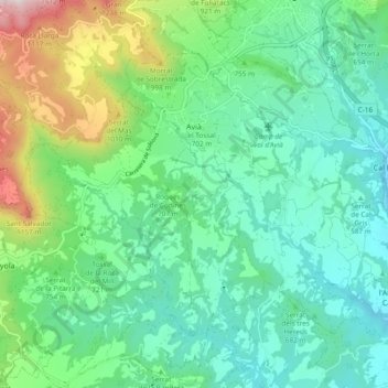
Name: Avià topographic map, elevation, terrain.
Location: Avià, Berguedà, Barcelona, Cataluña, 08610, España (42.03969 1.77906 42.09076 1.87334)
Average elevation: 711 m
Minimum elevation: 478 m
Maximum elevation: 1,406 m
Other topographic maps
Click on a map to view its topography, its elevation and its terrain.
Pla de la Font
España > Cataluña > Berguedà > Espunyola
Pla de la Font, Espunyola, Berguedà, Barcelona, Cataluña, 08683, España
Average elevation: 662 m