Geolocate

Thurso topographic map

Click on the map to display elevation.

About this map

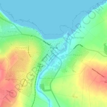
Name: Thurso topographic map, elevation, terrain.

Location: Thurso, Caithness, Scotland, United Kingdom (58.58098 -3.55606 58.60531 -3.50003)

Average elevation: 25 m

Minimum elevation: 0 m

Maximum elevation: 68 m

Other topographic maps

Click on a map to view its topography, its elevation and its terrain.

Dounreay

United Kingdom > Scotland > Caithness

Average elevation: 36 m

Gear up for your next adventure:

🧼Biodegradable Soap - Eco-friendly outdoor soap
🆘Personal Locator Beacons (PLB) - Satellite emergency beacons for life-saving help in areas with no mobile coverage
🪑Portable Backpacking Chairs - A comfortable seat for studying maps at the end of the day
🧦Hiking Socks - Comfortable socks for long hikes
🔪Camping Knives - Multi-purpose outdoor knives

As an Amazon Associate, this site earns from qualifying purchases at no extra cost to you.