
Huntsville topographic map
Interactive map
Click on the map to display elevation.
About this map
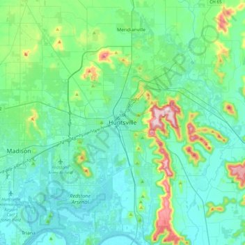
Name: Huntsville topographic map, elevation, terrain.
Average elevation: 225 m
Minimum elevation: 167 m
Maximum elevation: 503 m
Other topographic maps
Click on a map to view its topography, its elevation and its terrain.
Lakewood Manor
Vereinigte Staaten von Amerika > Alabama > Madison County > Huntsville
Lakewood Manor, Huntsville, Madison County, Alabama, 35810, Vereinigte Staaten von Amerika
Average elevation: 222 m