
Thank you for supporting this site ❤️
Make a donation
Make a donation
Gear up for your next adventure:
As an Amazon Associate, this site earns from qualifying purchases at no extra cost to you.
Birkfeld topographic map
Click on the map to display elevation.
Thank you for supporting this site ❤️
Make a donation
Make a donation
Gear up for your next adventure:
As an Amazon Associate, this site earns from qualifying purchases at no extra cost to you.
About this map
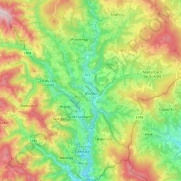
Name: Birkfeld topographic map, elevation, terrain.
Location: Birkfeld, Bezirk Weiz, Styria, 8190, Austria (47.29436 15.58581 47.42177 15.74950)
Average elevation: 862 m
Minimum elevation: 494 m
Maximum elevation: 1,428 m
Thank you for supporting this site ❤️
Make a donation
Make a donation
Gear up for your next adventure:
🎒40L Day Hiking Backpacks - Comfortable packs with hydration support for long days exploring topographic peaks
As an Amazon Associate, this site earns from qualifying purchases at no extra cost to you.