Geolocate

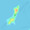
Cajimos topographic map

Click on the map to display elevation.

About this map

Name: Cajimos topographic map, elevation, terrain.

Location: Cajimos, Romblon, Mimaropa, 5500, Philippines (12.57460 122.25486 12.61460 122.29486)

Average elevation: 63 m

Minimum elevation: 0 m

Maximum elevation: 253 m

Other topographic maps

Click on a map to view its topography, its elevation and its terrain.

Alad

Philippines > Romblon > Romblon

Average elevation: 10 m

Logbon Island

Philippines > Romblon > Romblon > Logbon

Average elevation: 3 m

Gear up for your next adventure:

🔥Windproof Plasma Lighters - USB rechargeable lighters that work in high-altitude winds
🗺️Topographic Maps - Detailed maps for hiking and navigation
🕯️Emergency Whistles - Safety whistles for hiking
🧺Fast-Dry Microfiber Towels - Large towels that pack down to the size of an orange
🎒3L Hydration Reservoirs - Hands-free drinking to stay hydrated on steep contour climbs

As an Amazon Associate, this site earns from qualifying purchases at no extra cost to you.