
Kearney topographic map
Interactive map
Click on the map to display elevation.
About this map
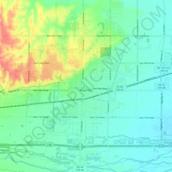
Name: Kearney topographic map, elevation, terrain.
Location: Kearney, Buffalo County, Nebraska, USA (40.66067 -99.13867 40.74271 -99.01811)
Average elevation: 662 m
Minimum elevation: 645 m
Maximum elevation: 706 m
Other topographic maps
Click on a map to view its topography, its elevation and its terrain.
Governor Island
Governor Island, Kearney, Buffalo County, Nebraska, 68848, USA
Average elevation: 662 m