Geolocate

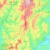
Runruno topographic map

Click on the map to display elevation.

About this map

Name: Runruno topographic map, elevation, terrain.

Location: Runruno, Nueva Vizcaya, Cagayan Valley, Philippines (16.40550 121.30377 16.44550 121.34377)

Average elevation: 586 m

Minimum elevation: 358 m

Maximum elevation: 943 m

Other topographic maps

Click on a map to view its topography, its elevation and its terrain.

Kasibu River

Philippines > Nueva Vizcaya > Kasibu

Average elevation: 866 m

Casecnan River

Philippines > Nueva Vizcaya > Pelaway

Average elevation: 963 m

Kayapa

Philippines > Nueva Vizcaya

Average elevation: 1,258 m

Gear up for your next adventure:

🎒Dry Bags - Waterproof bags for outdoor gear
📣High-Decibel Survival Whistles - Signaling tool for rescue that carries much further than a human voice
🏕️Camping Gear - Essential camping equipment
🦶Orthotic Hiking Insoles - Extra arch support for long-distance topographic treks
🛠️Outdoor Repair Kits - Gear repair kits

As an Amazon Associate, this site earns from qualifying purchases at no extra cost to you.