
Blue Creek topographic map
Interactive map
Click on the map to display elevation.
About this map
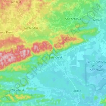
Name: Blue Creek topographic map, elevation, terrain.
Location: Blue Creek, Toledo District, Toledo, Belize (16.14164 -89.10065 16.26747 -88.99158)
Average elevation: 115 m
Minimum elevation: 2 m
Maximum elevation: 457 m
Other topographic maps
Click on a map to view its topography, its elevation and its terrain.