
Mont Mézenc topographic map
Interactive map
Click on the map to display elevation.
About this map
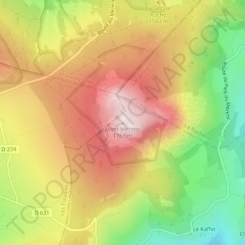
Name: Mont Mézenc topographic map, elevation, terrain.
Average elevation: 1,487 m
Minimum elevation: 1,200 m
Maximum elevation: 1,739 m
Other topographic maps
Click on a map to view its topography, its elevation and its terrain.
Borée
Frankreich > Auvergne-Rhone-Alpen > Borée
Borée, Largentière, Ardèche, Auvergne-Rhone-Alpen, Metropolitanes Frankreich, 07310, Frankreich
Average elevation: 1,123 m