Geolocate

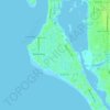
Bailey Hall topographic map

Click on the map to display elevation.

About this map

Name: Bailey Hall topographic map, elevation, terrain.

Location: Bailey Hall, Siesta Key, Sarasota County, Florida, 34242, United States (27.26338 -82.58288 27.30338 -82.54288)

Average elevation: 2 m

Minimum elevation: -1 m

Maximum elevation: 16 m

Other topographic maps

Click on a map to view its topography, its elevation and its terrain.
Gear up for your next adventure:

🧊Insulated Stainless Steel Flasks - Keep water cold for 24 hours in the heat or coffee hot in the cold
🧼Clip-on Hand Sanitizer - Maintain hygiene when water for washing is scarce
🧤Hiking Gloves - Protective gloves for outdoor use
🧯Animal Deterrent Spray - Safety spray for wildlife
🎨Portable Watercolor Kits - Paint the landscapes and topographic views you discover

As an Amazon Associate, this site earns from qualifying purchases at no extra cost to you.