Geolocate

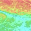
Target Island topographic map

Click on the map to display elevation.

About this map

Name: Target Island topographic map, elevation, terrain.

Location: Target Island, West Nipissing, Nipissing District, Northeastern Ontario, Ontario, Canada (46.22414 -79.82583 46.22512 -79.82222)

Average elevation: 194 m

Minimum elevation: 190 m

Maximum elevation: 216 m

Other topographic maps

Click on a map to view its topography, its elevation and its terrain.
Lavigne

Canada > Ontario > Nipissing District > West Nipissing

Average elevation: 203 m

Verner

Canada > Ontario > Nipissing District > West Nipissing

Average elevation: 228 m

Glen Afton

Canada > Ontario > Nipissing District > West Nipissing

Average elevation: 274 m

Gear up for your next adventure:

🦟Heavy Duty Insect Repellent - Essential protection against flies, mozzies, and march flies
📸Action Cameras - Record your journey across interesting topographic features in 4K
📱Tablet Tripod Mounts - Steady platforms for viewing digital maps or taking long exposures
🔦LED Torches - LED torches for outdoor use
🔌Fast Charging Adapters - Quickly top up all your gear before heading back into the field

As an Amazon Associate, this site earns from qualifying purchases at no extra cost to you.