Geolocate

Saguing topographic map

Click on the map to display elevation.

About this map
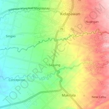
Name: Saguing topographic map, elevation, terrain.

Location: Saguing, Makilala, Cotabato, Soccsksargen, 9401, Philippines (6.96848 125.04744 6.99994 125.11525)

Average elevation: 237 m

Minimum elevation: 137 m

Maximum elevation: 380 m

Gear up for your next adventure:

🧦Hiking Socks - Comfortable socks for long hikes
🧴SPF 50+ Bulk Sunscreen - Maximum protection for long-term outdoor exposure
📕Hiking Guide Books - Guides for hiking trails
🧢Outdoor Sun Hats - Sun protection hats for hiking
🏃Compression Recovery Socks - Reduce leg fatigue after heavy days of elevation gain

As an Amazon Associate, this site earns from qualifying purchases at no extra cost to you.