Geolocate

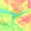
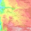
Sumucab topographic map

Click on the map to display elevation.

About this map

Name: Sumucab topographic map, elevation, terrain.

Location: Sumucab, Cavinti, Laguna, Calabarzon, 4013, Philippines (14.19995 121.54867 14.22692 121.60660)

Average elevation: 373 m

Minimum elevation: 262 m

Maximum elevation: 463 m

Other topographic maps

Click on a map to view its topography, its elevation and its terrain.
Cavinti

Philippines > Laguna > Cavinti

Average elevation: 250 m

Pagsanjan Falls

Philippines > Laguna > Cavinti

Average elevation: 214 m

Silangan Talaongan

Philippines > Laguna > Cavinti

Average elevation: 288 m

Sumucab

Philippines > Laguna > Cavinti

Average elevation: 370 m

Layasin

Philippines > Laguna > Cavinti

Average elevation: 253 m

Gear up for your next adventure:

⌛Survival Blankets - Emergency thermal blankets
⌚Altimeter Barometer Watches - Outdoor watches with built-in sensors to track altitude changes and weather shifts
🔦Powerful LED Headlamps - Hands-free lighting for night navigation and setting up camp after dark
👖Convertible Hiking Trousers - Zip-off legs to adapt to changing temperatures throughout the day
🎨Portable Watercolor Kits - Paint the landscapes and topographic views you discover

As an Amazon Associate, this site earns from qualifying purchases at no extra cost to you.