
North Great Plain topographic map
Interactive map
Click on the map to display elevation.
About this map
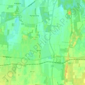
Name: North Great Plain topographic map, elevation, terrain.
Location: North Great Plain, Great Plain and North, 4551, Hungary (47.93440 21.74734 47.98780 21.84028)
Average elevation: 110 m
Minimum elevation: 100 m
Maximum elevation: 125 m
Other topographic maps
Click on a map to view its topography, its elevation and its terrain.