Geolocate

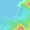
Langogan topographic map

Click on the map to display elevation.

About this map

Name: Langogan topographic map, elevation, terrain.

Location: Langogan, Puerto Princesa, Mimaropa, Philippines (10.01210 119.10373 10.05210 119.14373)

Average elevation: 132 m

Minimum elevation: -6 m

Maximum elevation: 613 m

Other topographic maps

Click on a map to view its topography, its elevation and its terrain.

Baywalk Park

Philippines > Puerto Princesa

Average elevation: 6 m

Bacungan River

Philippines > Puerto Princesa

Average elevation: 123 m

Irawan River

Philippines > Puerto Princesa

Average elevation: 120 m

Tagkawayan Beach

Philippines > Puerto Princesa

Average elevation: 48 m

Sabang River

Philippines > Puerto Princesa

Average elevation: 39 m

Manors Verdant

Philippines > Puerto Princesa

Average elevation: 5 m

Gear up for your next adventure:

🏃Compression Recovery Socks - Reduce leg fatigue after heavy days of elevation gain
🧼Biodegradable Outdoor Soap - Clean gear and yourself without harming the local ecosystem
🧼Biodegradable Soap - Eco-friendly outdoor soap
🥾Heavy Duty Hiking Boots - Ankle-supporting boots for carrying heavy packs on steep contours
🩹Wilderness First Aid Kits - Comprehensive medical kits tailored for hiking and remote exploration

As an Amazon Associate, this site earns from qualifying purchases at no extra cost to you.