
Harvey topographic map
Click on the map to display elevation.
About this map
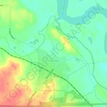
Name: Harvey topographic map, elevation, terrain.
Location: Harvey, Marion County, Iowa, United States (41.31000 -92.93181 41.32879 -92.91279)
Average elevation: 223 m
Minimum elevation: 199 m
Maximum elevation: 260 m