Geolocate

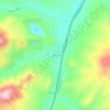
Cardwell topographic map

Click on the map to display elevation.

About this map

Name: Cardwell topographic map, elevation, terrain.

Location: Cardwell, Jefferson County, Montana, United States (45.84987 -111.97835 45.87704 -111.93007)

Average elevation: 1,314 m

Minimum elevation: 1,296 m

Maximum elevation: 1,506 m

Other topographic maps

Click on a map to view its topography, its elevation and its terrain.

Montana City

United States > Montana > Jefferson County

Average elevation: 1,299 m

Clancy

United States > Montana > Jefferson County

Average elevation: 1,370 m

Jefferson City

United States > Montana > Jefferson County

Average elevation: 1,489 m

Legget Hill

United States > Montana > Jefferson County

Average elevation: 1,988 m

Gear up for your next adventure:

🪑Portable Backpacking Chairs - A comfortable seat for studying maps at the end of the day
☀️Portable Solar Chargers - High-efficiency panels to hang on your backpack while walking
🍶Collapsible Water Bottles - Save space in your pack as you consume your water supply
🌧️Rain Jackets - Waterproof jackets for hiking
👕UPF 50+ Sun Shirts - Essential protection against the harsh Australian sun during field work

As an Amazon Associate, this site earns from qualifying purchases at no extra cost to you.