
達仁鄉 topographic map
Interactive map
Click on the map to display elevation.
About this map
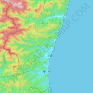
Name: 達仁鄉 topographic map, elevation, terrain.
Location: 達仁鄉, Taitung, 臺灣省, 966, Taiwan (22.22978 120.74346 22.50874 120.94249)
Average elevation: 362 m
Minimum elevation: -3 m
Maximum elevation: 1,932 m