
San Pantaleón de Aras topographic map
Interactive map
Click on the map to display elevation.
About this map
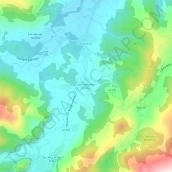
Name: San Pantaleón de Aras topographic map, elevation, terrain.
Location: San Pantaleón de Aras, Trasmiera, Cantabria, 39766, España (43.32489 -3.51642 43.36489 -3.47642)
Average elevation: 132 m
Minimum elevation: 10 m
Maximum elevation: 459 m